Tunnel Near Knic and 30 Bridges to Be Built on Gruza Corridor Route – Fast Road for 100 km/h After All
Source: eKapija
 Friday, 12.01.2024.
 08:27
08:27
 Friday, 12.01.2024.
 08:27
08:27
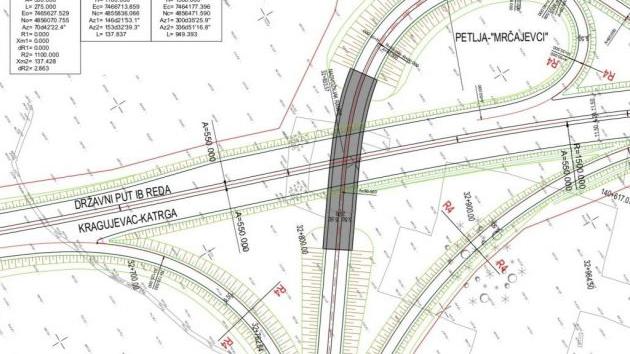
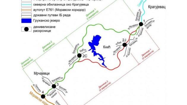
The position of the route relative to the surroundings (Photo: JP Putevi Srbije)

As can be seen from the document, the construction of four interchanges, 30 bridge structures, 24 underpasses and overpasses, as well as the construction of the Vuckovica tunnel of 670 m, not far from Knic, is planned.
The future fast route encompasses parts of the city of Kragujevac, the municipality of Knic and the city of Cacak. In the territory of the city of Kragujevac, the plan covers the cadaster municipality Djuriselo, in the territory of the municipality of Knic, the cadaster municipalities: Vuckovica, Raskovic, Brnjica, Dragusica, Oplanici, Toponica, Becevica, Kusovac, Radmilovic, Pretoke, Guncati and Bumbarevo Brdo, whereas in the territory of the city of Cacak, it encompasses the cadaster municipalities: Bresnica, Becanj and Katrga.
The planned route
The planned route of the fast road with a total length of 36 km begins at the planned interchange (de-leveled intersection) Dragobraca (the ring road of the city of Kragujevac), stretches toward the west and southwest and mostly takes over the function of the existing IB-grade state road no. 46.
In addition to taking up transit traffic flows, the biggest significance of the planned route lies in the moving of the transit routes outside the building area of the municipal center of Knic and the zones of the sanitary protection of the water spring (water accumulation) Gruza.
Going around the area of the Gruza water accumulation on the north and west sides, the route crosses the existing IIB-grade state road no. 380 (the planned interchange Knic) and the existing IB-grade road no. 46 (the planned interchange Bumbarevo Brdo).
At the far south end, the fast route crosses, that is, connects the traffic routes with the existing IB-grade state road no. 22 (the planned interchange Mrcajevci) and, farther to the south, connects through the Katrga interchange with the Morava Corridor.
The route is conditionally split into three sections:
– section 1 (km 0+000 - km 23+150) – begins at the planned interchange (de-leveled intersection) Dragobraca (the ring road of the city of Kragujevac), with the dominant function of moving the transit routes outside the building area of the municipal center of Knic and the zones of the sanitary protection of the water spring (water accumulation) Gruza, and stretches to the intersection with the existing IB-grade road no. 46 (the planned interchange Bumbarevo Brdo);
– section 2 (km 23+150 - km 32+000) – begins at the planned interchange Bumbarevo Brdo, has the dominant function of connecting the traffic routes with the existing IB-grade state road no. 46 and the existing IB-grade state road no. 22, and stretches to the crossing with the existing IB-grade state road no. 22 (the planned interchange Mrcajevci);
– section 3 (km 32+000 - km 35+955) – begins at the planned interchange Mrcajevci, has the dominant function of connecting the routes of the fast road, the existing IB-grade state road no. 22 and the IA-grade state road A5 (E-761, under construction), and stretches to the final cote km 35+955, that is, the planned interchange Katrga.
This division of the route into three sections is defined only for the purposes of the preparation of the Spatial Plan of the Special-Purpose Area. In the further phases of the preparation of the technical documentation, a different division of the route into sections is possible.
Four interchanges to remain, with slight changes
On the route, 24 de-leveled crossings – underpasses and overpasses are planned along the whole route. The plan also includes the construction of 30 bridges across the water flows and local roads, as well as the Vuckovica tunnel.
The preliminary design plans four interchanges, that is, de-leveled intersections: Knic, Bumbarevo Brdo, Bresnica-Mrcajevci and Katrga.
Compared to the location and the concept defined within the General Project, after the early public inspection of the Spatial Plan of the Special-Purpose Area and the suggestions made, certain changes have occurred when it comes to the solutions for the de-leveled crossings.
In concrete terms, after the municipality of Knic made its suggestions, the preliminary design now also develops the de-leveled crossing Knic, by which the IIB-grade road no. 380 is also connected with the fast route.
When it comes to the de-leveled intersection Bumbarevo Brdo, the functional type of the intersections remains the same as in the General Project, but the microlocation has changed, whereby the preliminary design now features a direct connection with the IB-grade state road no. 46. The location of the maintenance base is also defined within this interchange.
Also, after an upgraded topographic base was provided and due to the implementation of technical solutions of a more efficient drainage, the de-leveled intersection Mrcajevci-Bresnica has been changed in the sense of the locations of the barriers, but the location of the crossing itself, its type and the functional level have remained essentially the same.
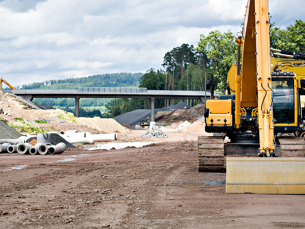
Illustration (Photo: Val Thoermer/shutterstock.com)

Vuckovica tunnel
According to the preliminary design, at the very top of the Vuckovica mountain pass, a tunnel with a length of around 670 m is planned (in the General Project, the length amounted to around 400 meters).
– After detailed surveying and the preparation of an up-to-date topographic base, compared to the General Project, where a shallow-foundation tunnel was planned, with merged tubes, it has been decided for a deep-foundation tunnel to be planned in the phase of the further development of the project – it is said.
The reason for the change lies primarily, as explained, in getting a much bigger depth of the overburden in the location of the tunnel structure (up to 40 meters), compared to the General Project.
– After getting the new base, two options for the route in this part were presented to the investor – the slope and the tunnel option. The slope option entailed the eschewing of the tunnel structure, but with the use of border elements of the plan and the profile and negative effects in spots, arising from the harmonization of the elements of the plan and the profile of the road – the document says.
On the other hand, it is added, the tunnel option eliminated all those negative effects, but with the implementation of a tunnel structure with deep foundations, with tube lengths of 670 and 680 meters. The investor finally approved the proposed tunnel option.
The Vuckovica tunnel is designed with two separate tunnel tubes, one for each traffic direction. The orientation cotes of the portals of the right-hand tunnel tube are: entrance at km 2+230.00, exit at km 2+870.00 (relative to the axis of the right-hand tunnel tube). The orientation length of the right-hand tunnel tube is 640 m. The orientation cotes of the portals of the left-hand tunnel tubes are: entrance at km 2+280.00, exit at km 2+915.00 (relative to the axis of the left-hand tunnel tube). The orientation length of the left-hand tunnel tube is 635 m.
Two parking lots are planned in the fast route corridor: the parking lot Banjica at km 7+100 on both sides and the parking lot Bresnica at km 28+350 on both sides.
Also, the rest stop Jezero is planned at km 16+100, on both sides.
Speed of up to 100 km/h, with potential future increase
In 2020, the General Project of the traffic route was prepared and confirmed, entailing the construction of a highway profile for an estimated speed of 130 km/h.
However, based on the conclusions from the Previous Feasibility Study, it was decided for a fast route profile with an estimated speed of up to 100 km/h to be developed in the preliminary design phase.
– During the development of this Preliminary Design, in agreement with the investor, elements of the plan and the profile of the road which match a speed of 130 km/h have been enabled, to the end of allowing the potential expansion of the profile of the fast route into a highway profile in the future – the document says.
Take a look at our info-map Construction of Highways and Fast Roads in Serbia and the Region.
I. Z.
Tags:
Roads of Serbia
Ministry of Environmental Protection
IB grade fast road from Kragujevac to Morava Corridor
Katrga
Bresnica
Bumbarevo Brdo
Guncati
Pretoke
Radmilović
Kusovac
Bečevica
Toponica
Oplanić
Dragušica
Brnjica
Rašković
Vučkovica
Goločelo
Đuriselo
Dragobraća
Gruža Corridor
Kragujevac Mrčajevci fast road
Vučkovica tunnel
construction of Vučkovica tunnel
Comments
Your comment
Naš izbor
Most Important News
Full information is available only to commercial users-subscribers and it is necessary to log in.
Follow the news, tenders, grants, legal regulations and reports on our portal.
Registracija na eKapiji vam omogućava pristup potpunim informacijama i dnevnom biltenu
Naš dnevni ekonomski bilten će stizati na vašu mejl adresu krajem svakog radnog dana. Bilteni su personalizovani prema interesovanjima svakog korisnika zasebno,
uz konsultacije sa našim ekspertima.


 Izdanje Srbija
 Serbische Ausgabe
 Izdanje BiH
 Izdanje Crna Gora


 News
News


